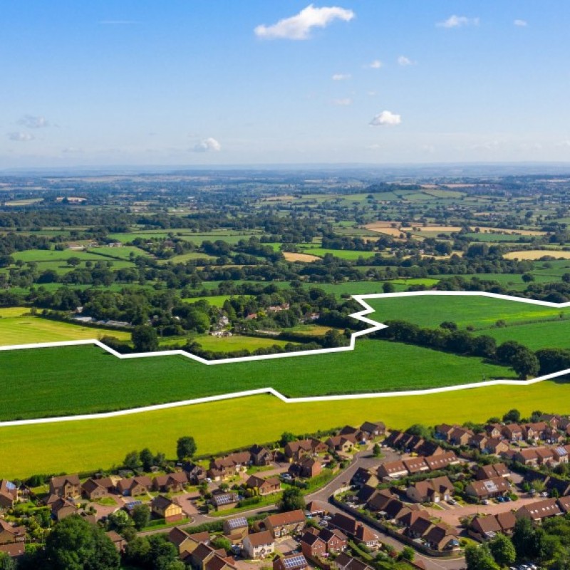
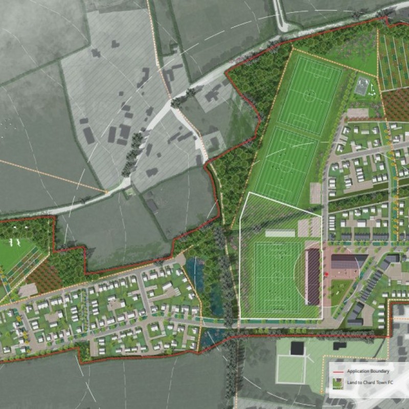
Map
Please note: Locations and addresses are approximate and may not be as accurate as expected.
Planning
Application reference: 18/04057/OUT
Planning status: Outline Planning Permission
Planning authority: South Somerset District Council
Application details:
On 18th February 2020 South Somerset District Council resolved to grant outline planning permission, subject to completion of a legal agreement, for a mixed use development including the following elements:
- Up to 295 dwellings.
- Floodlit full size football pitch.
- Unlit full size training pitch and community sports pitch with associated multi use clubhouse spectator facilities and vehicular parking area.
- Hub for local neighbourhood facilities and other community uses.
- Vehicular and pedestrian accesses.
The proposed development will be accessed from the east via Thorndun Park Drive. Although the existing estate road which abuts the eastern boundary of the site is not currently adopted, South Somerset District Council accepts that as per the terms of a Development Agreement with the Seller, dated 29th October 1988, this road was to be constructed to an adoptable standard and subsequently adopted.
LandHawk is a comprehensive database of recent and historical planning applications. Designed to deliver powerful, detailed search with greater accuracy and control.
Get instant insight into the status of any area within the country, with a reliable data source that combines 99% of all available planning application data across UK local authorities.
We have exclusively partnered up with LandHawk so you can immediately understand the planning situation of the empty property or site you are looking at. When you sign up and contacted by LandHawk, please say you singed up via LandAttic and you will immediately receive an extended 60 day free trial!
Ownership
LandHawk hosts, manages and displays a digitised version of every land parcel in the UK, as produced by His Majesty's Land Registry (HMLR) and, in the case of Scotland, Registers of Scotland using the INSPIRE data. Each land parcel contains the land registry title deed number and, in the cases of commercial and overseas ownership, directly accessible information for the ownership of that land parcel.
We have exclusively partnered up with LandHawk so you can immediately investigate the ownership of an empty property or derelict site you are looking at. When you sign up and contacted by LandHawk, please say you singed up via LandAttic and you will immediately receive an extended 60 day free trial!


