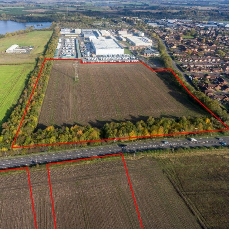
Map
Please note: Locations and addresses are approximate and may not be as accurate as expected.
Planning
Application reference: 15/00493/OUT
Planning status: Outline Planning Permission
Application details:
Proposals have been developed for a proposed mixed use development, that includes the existing outline application relating to residential development within the southern section of the western part of the site. The site as a whole is identified within the Site Allocation Policy MU3, Preferred Option for a Mixed-Use Site for Retford, comprising 175 dwellings and 15.7 hectares of employment land. A new proposed roundabout will provide access to both the eastern and western parts of the site. This roundabout will also serve as a gateway welcoming element and receive an appropriate high quality landscape treatment.
The illustrative master plan has been designed to ensure a high quality and
sustainable development which respects, maintains and enhances both
the existing urban fabric, the local community and the adjoining wider
landscape. The scheme seeks to be visually attractive, respecting the
context, form and type of existing built form and building styles evident
within the local area.
LandHawk is a comprehensive database of recent and historical planning applications. Designed to deliver powerful, detailed search with greater accuracy and control.
Get instant insight into the status of any area within the country, with a reliable data source that combines 99% of all available planning application data across UK local authorities.
We have exclusively partnered up with LandHawk so you can immediately understand the planning situation of the empty property or site you are looking at. When you sign up and contacted by LandHawk, please say you singed up via LandAttic and you will immediately receive an extended 60 day free trial!
Ownership
LandHawk hosts, manages and displays a digitised version of every land parcel in the UK, as produced by His Majesty's Land Registry (HMLR) and, in the case of Scotland, Registers of Scotland using the INSPIRE data. Each land parcel contains the land registry title deed number and, in the cases of commercial and overseas ownership, directly accessible information for the ownership of that land parcel.
We have exclusively partnered up with LandHawk so you can immediately investigate the ownership of an empty property or derelict site you are looking at. When you sign up and contacted by LandHawk, please say you singed up via LandAttic and you will immediately receive an extended 60 day free trial!

