Map
Please note: Locations and addresses are approximate and may not be as accurate as expected.
Planning
Application reference: 16/0926/OUT
Planning status: Outline Planning Permission
Planning authority: Melton Borough Council
Application details:
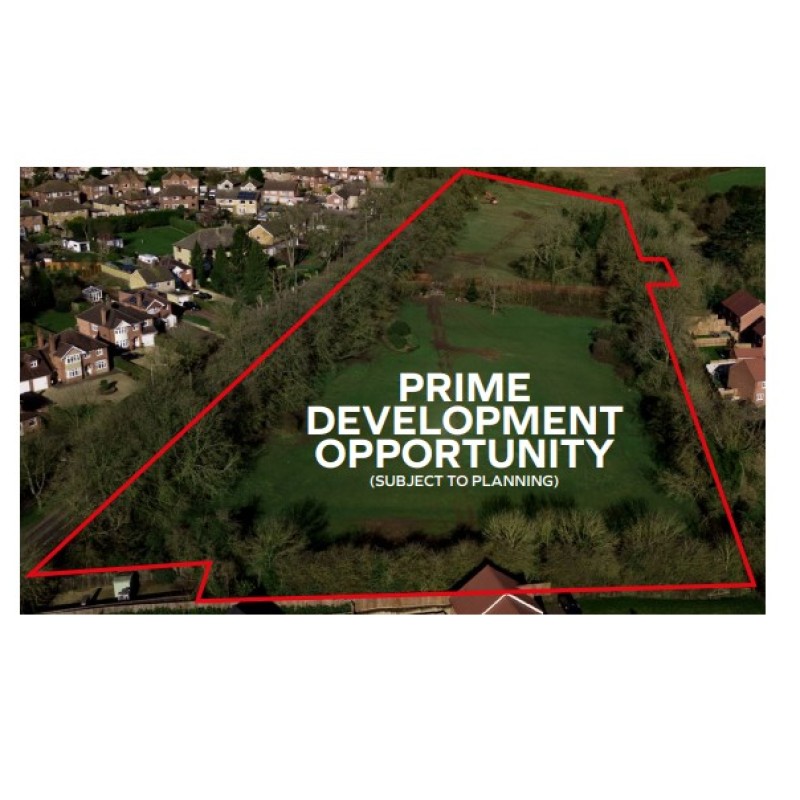
The principle of Residential and/or Care development of the site was supported by the Local Authority via a preapplication consultation process, which showed a proposed scheme of 42 residential dwellings.
A copy of the
submission document and Council
response can be found on the data room.
The Council supports the principle of residential development, as the site is surrounded by residential development/applications to all sides except the West. The Council agreed that the site has a close relationship to Melton Mowbray and surrounding residential development.
The Council’s Conservation Officer
does not object in principle to proposed
development along the boundary of
Sysonby Lodge’s listed curtilage and
states that development would not
negatively impact on the setting of
Sysonby Lodge providing that the use
of materials are sympathetic and align
with the design code established for the
neighbouring site (ref: 16/00926/OUT);
scale of dwellings do not exceed the
scale and ridge height of neighbouring
site; and, careful landscaping avoids
harm to the approach to Sysonby Lodge.
LandHawk is a comprehensive database of recent and historical planning applications. Designed to deliver powerful, detailed search with greater accuracy and control.
Get instant insight into the status of any area within the country, with a reliable data source that combines 99% of all available planning application data across UK local authorities.
We have exclusively partnered up with LandHawk so you can immediately understand the planning situation of the empty property or site you are looking at. When you sign up and contacted by LandHawk, please say you singed up via LandAttic and you will immediately receive an extended 60 day free trial!
Ownership
LandHawk hosts, manages and displays a digitised version of every land parcel in the UK, as produced by His Majesty's Land Registry (HMLR) and, in the case of Scotland, Registers of Scotland using the INSPIRE data. Each land parcel contains the land registry title deed number and, in the cases of commercial and overseas ownership, directly accessible information for the ownership of that land parcel.
We have exclusively partnered up with LandHawk so you can immediately investigate the ownership of an empty property or derelict site you are looking at. When you sign up and contacted by LandHawk, please say you singed up via LandAttic and you will immediately receive an extended 60 day free trial!

